A. Sutherland – AncientPages.com – Many legends surround the mysterious Kingdom of Garamantes, which was once situated in the oases of Fezzan, Libya.
This indigenous Saharan society had towns, flourishing oasis agriculture, technological achievements, and trading contacts with the Mediterranean and Sub-Saharan Africa. During the Neolithic period in Africa (ca 1000 BC) and until about the time of the Arab Conquest, dated to the 7th century AD, the Garamantes developed a sophisticated society with the fortified capital city Garama and other cities.
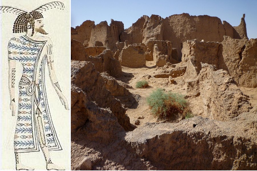
Left: Ancient Libyan, possibly Garamante, depicted in the tomb of Pharaoh Seti I. Image credit: Unknown (original) Heinrich Menu von Minutoli (1772–1846) (drawing) – Public Domain: Right: Ruins of Garama, the central city of the Garamantes. Image credit: Franzfoto – CC BY-SA 3.0
Politically organized in confederation, the Garamantes were governed by a king. The Garamantes were not desert barbarians living in one or two small towns and some settlements scattered across the vast realm of the Sahara Desert.
It was undoubtedly erroneous if someone had such an opinion about the Garamantes people.
We must not forget that this extraordinary, advanced society lived surrounded by the Sahara Desert, the world’s largest desert, where rainfall averages only half an inch yearly.
Yet, the Garamantes flourished, and so did their agriculture.
The Garamantes were cattle and horse breeders, charioteers, and light horses. They were skilled builders who possessed knowledge of architecture. This resourceful society built a 3,000-mile network of underground irrigation canals, which tapped into natural fossil water supplies laid down more than 40,000 years ago when rain last fell plentifully in the area.
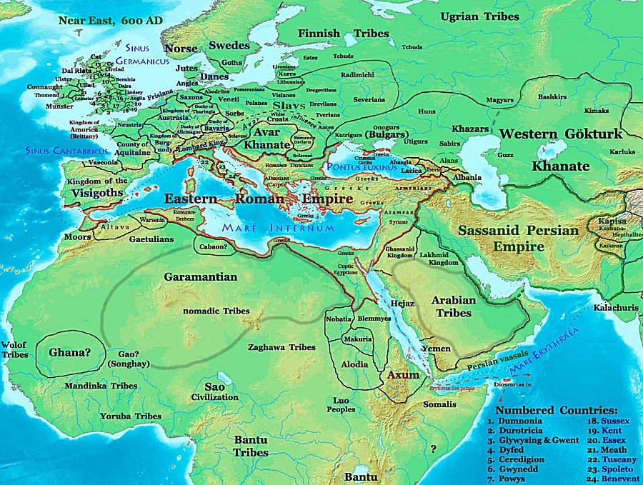 Location of the Garamantes in the Fezzan 600 AD, before the Islamic conquest. Image credit: Talessman – CC BY-SA 3.0
They practiced oasis agriculture; they were farmers and merchants whose diet included grapes, figs, wheat, and barley. They traded Rome’s wheat, salt, imported olive oil, oil lamps, and tableware.
According to Strabo and Pliny sources, the Garamantes mined amazonite in the Tibesti Mountains of the central Sahara. However, the analysis of their skeletons revealed that these people were healthy and not subjected to exhausting activities or regular warfare.
Their kingdom included eight or more major towns and many other settlements, considered as old as 3,000 years. As the 1960s excavations revealed, the Garamantes’ capital Garama (modern Germa), had approximately four thousand inhabitants, and another six thousand lived in villages within a 5 km radius.
The peak of their prosperity is dated between 500 and ca 600 AD, before the Islamic Conquest.
The Garamantes successfully exploited fossil water sources to irrigate crops by practicing oasis agriculture. Their extraordinary society included many skilled artisans and manufacturers devoted to metalworking and textile production. Traces of these activities were unearthed at the archaeological sites.
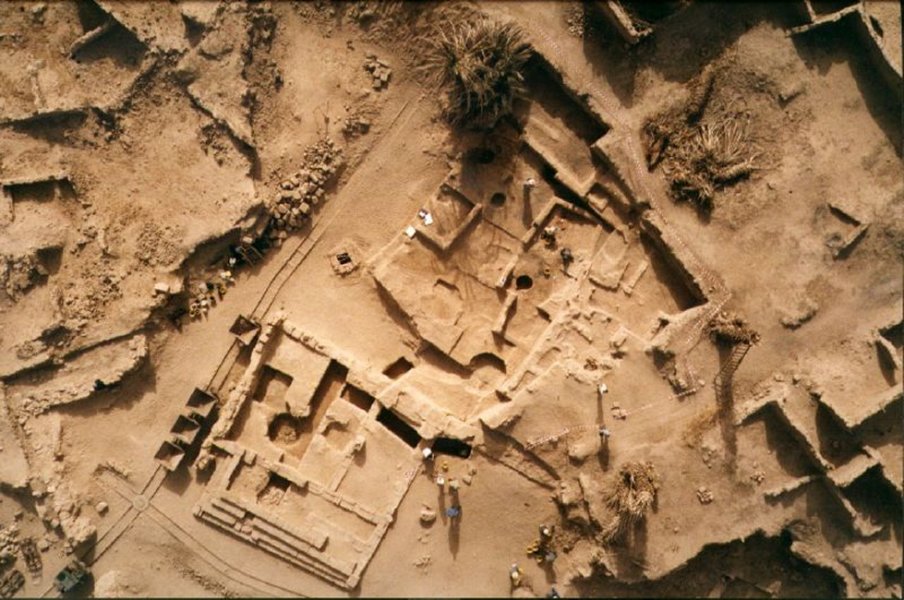
Aerial view of the ancient site of Garama. Image credit: Katy Tzaralunga – CC BY 2.0
They also left in legacy the abundant rock art, which often depicts life, before the rise of their kingdom.
Much of what we know of this civilization has originated from contemporary Greek and Roman foreign accounts and modern archaeological findings.
According to the Greek historian Herodotus, the Garamantes were a “very great nation.” Roman descriptions describe them as wearing scarifications and tattoos. Tacitus, a Roman historian and politician, wrote that they aided Tacfarinas, a former Roman soldier, during his rebellion between 17 and 24 AD and raided Greco – Roman coastal cities.
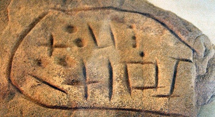
Ancient Garamante script. Image credit: Think Africa. Image source.
Significant research conducted by Professor David Mattingly of the University of Leicester’s School of Archaeology and Ancient History and his team opened our eyes to the lost civilization of the Garamantes people.
The discoveries revealed that the sun-beaten and arid lands of the Sahara have been much more crowded than previously thought. Around 150 AD, the Garamantes kingdom, located mainly along the Wadi al-Ajal, occupied an area that covered 180,000 square kilometers in southern Libya.
Using aerial pH๏τography and satellite imagery, Professor Mattingly and his team have pieced together the area’s archaeological heritage and discovered hundreds of fortified oasis settlements and advanced water and irrigation systems that sustained advanced oasis agriculture.
This fascinating Sahara civilization lasted from about -500 to 600 AD, and it was the time before the Islamic Conquest.
Professor Mattingly explained that ‘the new evidence suggests that the early medieval expansion of trade and settlement built on earlier initiatives, in which the Garamantes had played a significant role.’
Today we know much more about the mysterious Garamantes, a long-forgotten Saharan people who made the desert region flourish, built impressive cities, and controlled an empire of 70,000 square miles.
Their houses were not primitive nomadic camps scattered across the central Sahara but sophisticated, well-organized permanent urban settlements with villages inhabited by artisans, farmers, and merchants.
Written by – A. Sutherland – AncientPages.com Senior Staff Writer
Updated on October 7, 2022
Copyright © AncientPages.com All rights reserved. This material may not be published, broadcast, rewritten or redistributed in whole or part without the express written permission of AncientPages.com
Expand for references
References:
Anthony R. Birley, Septimius Severus: The African Emperor
David Mattingly (ed.). Archaeology of Fezzan. Volume 1, Synthesis. London 2003
Idjennaden Bob, The Garamantes (The Forgotten Civilisations of Africa Book 4)
Trans Sahara Project